Created by an Anishinaabe artist, this map offers a view of the land as it was known before colonial borders were imposed. Shown in both color and black-and-white, it reflects the deep relationship between the Anishinaabe and their homelands, reminding us that identity and place are woven together. This map supports teaching about history, sovereignty, and the continuity of Anishinaabe presence beyond imposed boundaries.
Resource Category: Maps
See Anishinaabe-made maps of the region to contextualize learning in geographical and historical place.
-
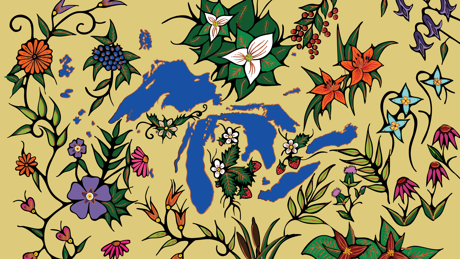
Before Borders: Anishinaabe Aki
-
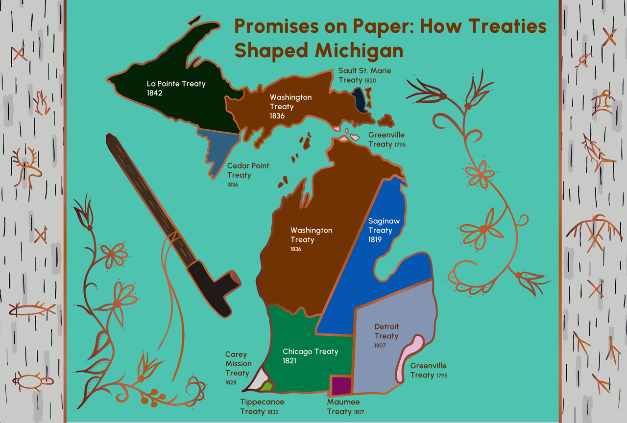
Promises on Paper: How Treaties Shaped Michigan
Created by an Anishinaabe artist, this map shows how treaty-making reshaped relationships between the Anishinaabe and the United States. These agreements altered Anishinaabe ancestral lands and allowed Michigan to become a state. The map offers a visual way to understand how treaties continue to shape history, sovereignty, and responsibilities today.
-
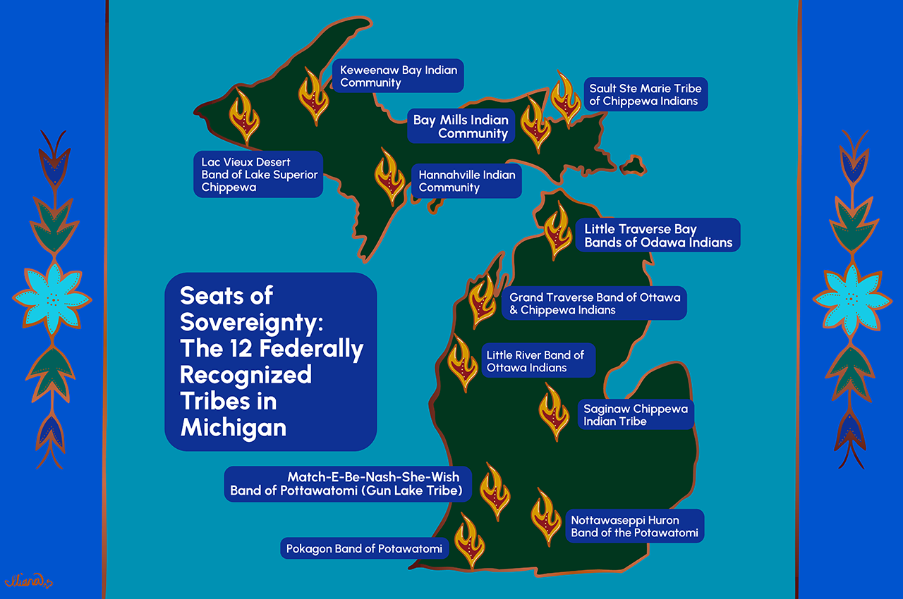
Seats of Sovereignty: The 12 Federally Recognized Tribes in Michigan
This map, created by an Anishinaabe artist, invites learners to see Michigan through the contemporary lens of Tribal sovereignty. Each seat of sovereignty marks where a Tribal Nation cares for its community and territory, honoring responsibilities that have been carried forward for generations. The map affirms the enduring presence of the 12 federally recognized Tribal Nations across the state.